Roanoke’s Regional Trails and Greenways

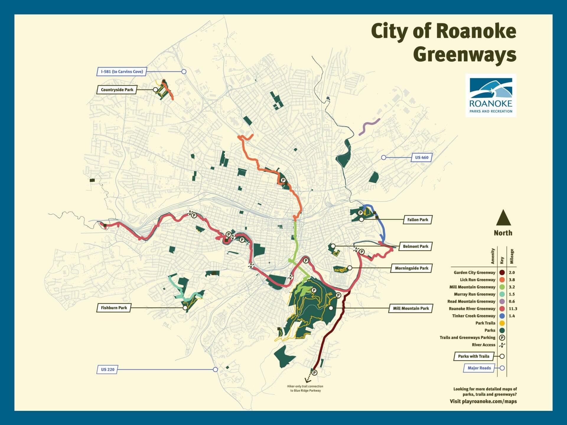
Roanoke Greenways Map

The Roanoke Region includes a network of beautiful greenways, blueways, and trails. Roanoke Parks and Recreation manages over 100 miles of trails and greenways in the City of Roanoke, including the Roanoke River Greenway, Carvins Cove Trails, Mill Mountain Greenway and Trails, and many more. Downloadable maps and more information available below.


City of Roanoke Greenways Map

Greenway and Trail Alerts

Know Before You Go with Statusfy trail and greenway alerts! Statusfy is an informational alert system meant to keep users informed. Statusfy allows trail and greenway users to view active and ongoing alerts (including short-term maintenance closures, long-term construction closures, flooding, detours, or event alerts). Note: Statusfy is not an emergency alert system. If you encounter an emergency situation in our parks or greenways, call 911.

Three easy ways to view Statusfy alerts:
  • View alerts online here, or at playroanoke.statusfy.com
  • Call the phone hotline to hear alerts at 540-858-1409
  • Download the free Statusfy app, then search “Roanoke”

Statusfy users have the option to sign up for email and/or text alerts to notify them automatically when updates are posted.

VIEW STATUSFY ALERTS

Carvins Cove Trails

CARVINS COVE TRAIL MAP

More Info

Tinker Creek Greenway

TINKER CREEK GREENWAY
(rOANOKE rIVER tO WISE AVE) MAP

TINKER CREEK GREENWAY
(HOLLINS TO CARVINS COVE)
MAP COMING SOON!

More Info

Murray Run Greenway and
Fishburn Park Trails

MURRAY RUN GREENWAY AND
FISHBURN PARK TRAILS MAP

More Info

Garden City Greenway

GARDEN CITY GREENWAY MAP

More Info

Read Mountain Greenway

READ MOUNTAIN GREENWAY MAP COMING SOON!

More Info

Morningside Park Trails

MORNINGSIDE PARK TRAIL MAP COMING SOON!

More Info

Fallon Park Cyclocross Course

Fallon Park Cyclocross Course

More Info